Daniel Crompton

Building Tools For Ecological Restoration

Geospatial data scientist focused on mycoremediation, brownfield assessment, and nature-based solutions

View Projects

About

Daniel Crompton

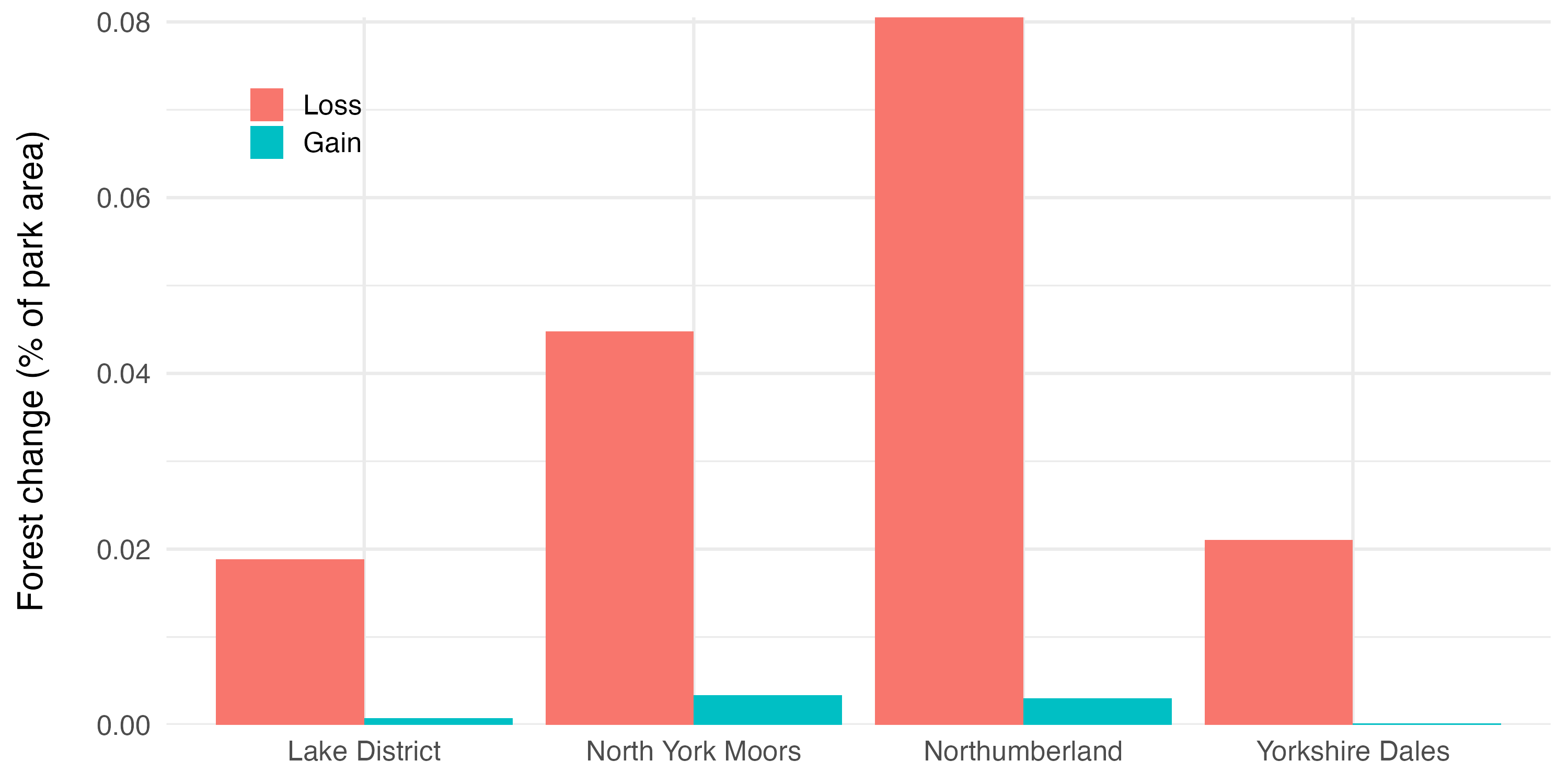
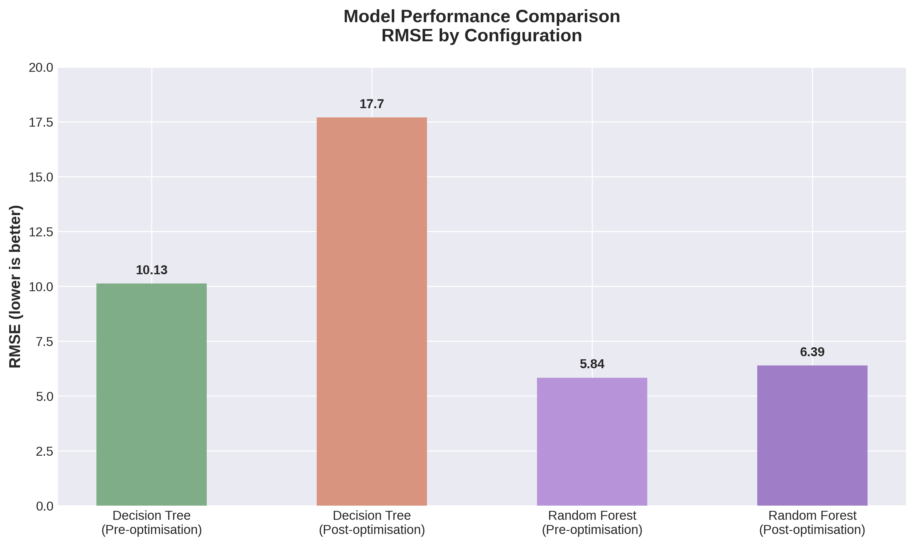
I'm developing geospatial data science skills with a focus on environmental restoration and nature-based solutions. After 20 years in quantity surveying and commercial management across major rail and civils projects, I'm building expertise in remote sensing, GIS, and predictive modelling through hands-on projects that address ecological challenges.

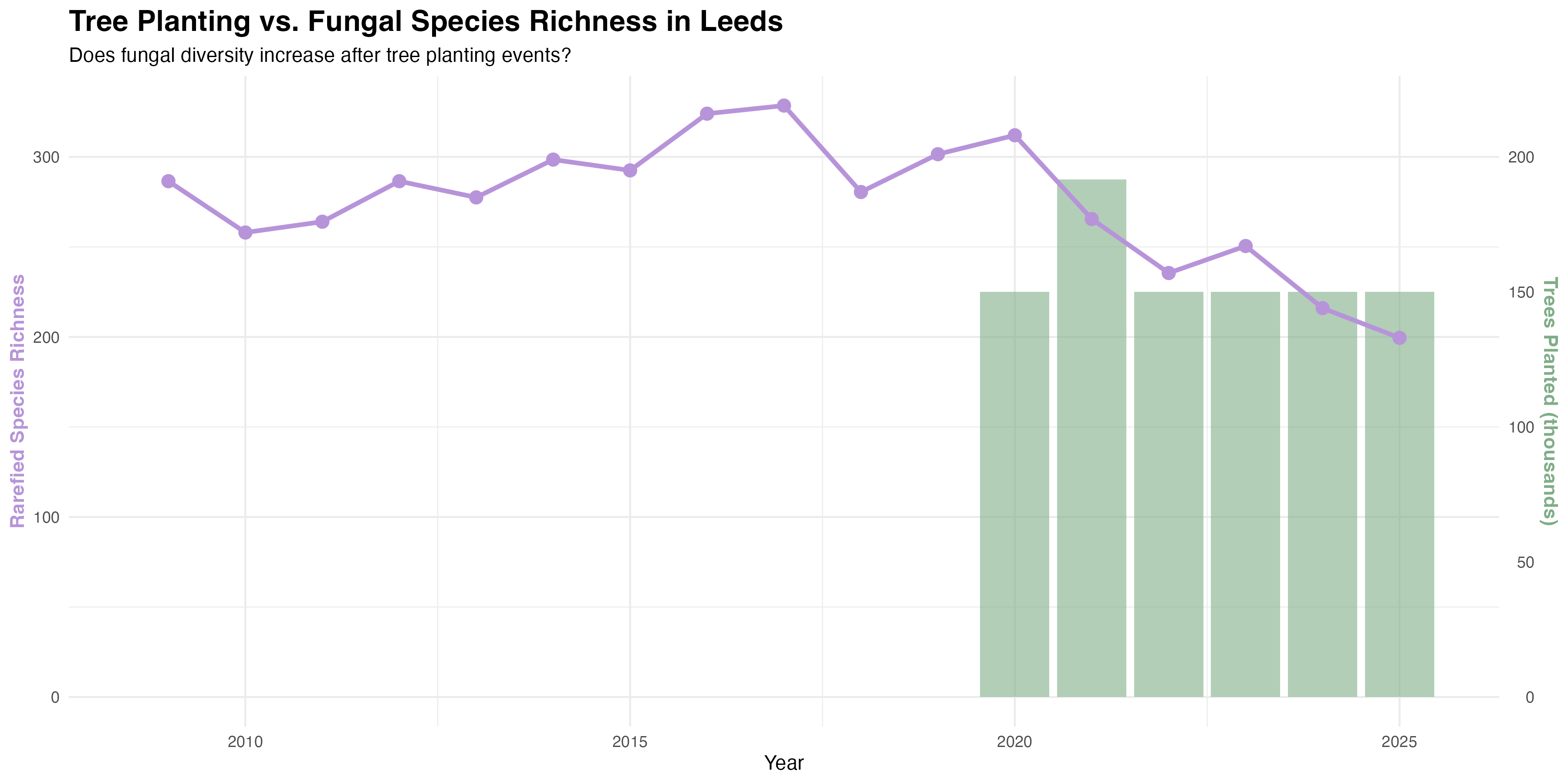
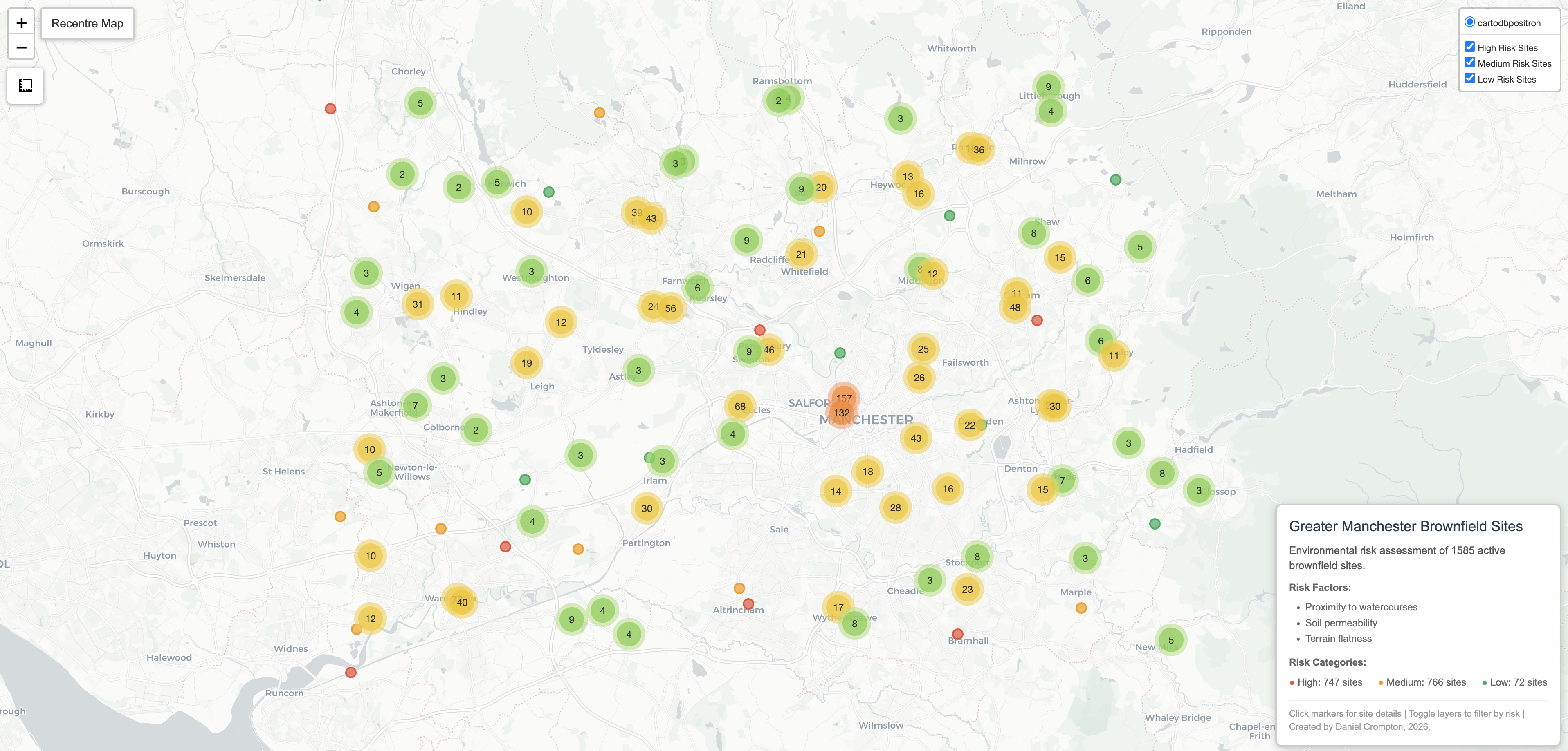
My particular interest is mycoremediation — using fungi to remediate contaminated brownfield sites — an approach I believe has transformative potential for healing ecosystems damaged by industrial activity. I combine satellite imagery analysis (Google Earth Engine), spatial statistics (R, Python), and interactive mapping (QGIS, Folium) to build tools that support ecological decision-making.

My background in commercial management gives me a unique perspective on making environmental interventions economically viable and stakeholder-friendly. I'm actively building a portfolio of geospatial projects while seeking opportunities to transition into environmental data science professionally.

Featured Projects

Leeds Fungal Biodiversity Analysis Completed

Leeds Fungal Biodiversity Analysis

Citizen science data analysis investigating whether urban tree planting supports fungal diversity recovery — revealing short-term mycorrhizal network disruption and challenging assumptions in restoration ecology.

Key Outcome: Fungal diversity declined after 2020 planting schemes, not increased — mycorrhizal proportion falling as saprotrophic fungi rose, consistent with soil disturbance disrupting established underground networks
Python R GBIF Folium GAM Citizen Science
Greater Manchester Brownfield Risk Map Completed

Greater Manchester Brownfield Restoration Potential

Geospatial analysis identifying 1,585 brownfield sites with environmental risk assessment and restoration suitability modelling using satellite data, soil analysis, and terrain characteristics.

Key Outcome: Identified 746 high-risk sites covering 772 hectares suitable for mycoforestry interventions
Google Earth Engine R Python QGIS Folium ML
UK National Parks Forest Change Completed

UK National Parks Forest Cover Change Analysis

Remote sensing workflow analysing forest loss and gain (2000–2024) across Yorkshire Dales, North York Moors, Lake District, and Northumberland using Google Earth Engine and R.

Key Outcome: Net forest loss across all four parks over 24 years, with Northumberland showing ~8% loss — likely driven by Kielder Forest commercial felling cycles
Google Earth Engine R Remote Sensing ggplot2
CO2 Model Performance Comparison Academic

CO₂ Emissions Prediction Using Machine Learning

Predicted UK industrial CO₂ emissions from green energy adoption data using Decision Tree and Random Forest regressors, with genetic algorithm feature selection and GridSearchCV optimisation.

Key Outcome: Random Forest outperformed Decision Tree (RMSE 5.84 vs 17.70 post-optimisation), demonstrating ensemble methods' robustness on small datasets
Python scikit-learn Machine Learning Regression
View All Projects

Skills & Expertise

Environmental Focus

  • Mycoremediation & Bioremediation
  • Brownfield Site Assessment
  • Habitat Suitability Modelling
  • Ecological Restoration Planning

Geospatial Analysis

  • Google Earth Engine
  • QGIS
  • Python (GeoPandas, Folium, Rasterio)
  • R (sf, raster, ggplot2)
  • Remote Sensing

Data Science & ML

  • Machine Learning (scikit-learn)
  • Regression Analysis & Forecasting
  • Statistical Modelling
  • Natural Language Processing
  • Data Visualisation
  • Python & R

Get In Touch

Open to collaboration on environmental data science projects and actively seeking opportunities in geospatial analysis and ecological restoration